Kastro Louloudas Apr. 2012.

We have promised to bring an update of how to find the way up to Kastro Louloudas from Kokkari and mainly to tell if the marking of the beginning of the footpath was visible after the last fire.
Jan and I had a quick tour on our 'two-wheelers' to the end of the gravel road. The 'road' is absolutely not for ordinary cars or scooters! Even driving a Jeep-type or MC with off-road tires is not for beginners!
The tour was made the last day just before the suitcase had to be packed. Therefore we had no time for checking the footpath - maybe our physical condition also had some influence...
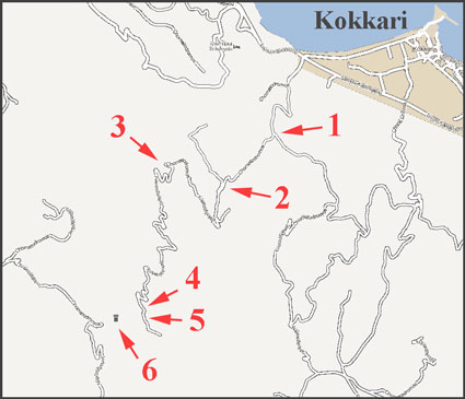
The result of the tour is shown below.
The distance from the main road by Kokkari to the footpath is 4.8 Km. It is up, up and up, but as well as we can see is the footpath the worst part.
We used around 1½ hour for our small tour.

  • 01_DSC3452First sign 0.8 Km from the main road. ('1' on map)
  • 02_DSC3451Turn right. Now there is only 4 Km of the easy part left.
  • 03_DSC3358At point '2' - turn left.
  • 04_DSC3355At point '2' - the sign is hard to read.
  • 05_DSC3365At point '3' - a nice place to rest.
  • 06_DSC3360'3' - Nice view.
  • 07_DSC3362'3' - Nice view.
  • 07_DSC3426'3' - Lots of flowers even wild orchids.
  • 07_DSC3428'3' - Lots of flowers even wild orchids.
  • 07_DSC3431'3' - Lots of flowers even wild orchids.
  • 07_DSC3433'3' - Lots of flowers even wild orchids.
  • 07_DSC3434'3' - Lots of flowers even wild orchids.
  • 07_DSC3435'3' - Lots of flowers even wild orchids.
  • 07_DSC3439'3' - Lots of flowers even wild orchids.
  • 07_DSC3446'3' - Lots of flowers even wild orchids.
  • 08_DSC3411'4' on map - After about 4.6 Km this small red dot shows the beginning of the footpath to the top.
  • 09_panorama1'4' - Two arrows showing the first markings. Top right arrow shows where to look for Kastro Louloudas.
  • 10_DSC3419'4' - Kastro Louloudas is behind the rock.
  • 11_DSC3385'5' - 200 m. further and looking back to point '4'
  • 12_DSC3375'5' - From here Kastro Louloudas is visible. Small stone piles (cairns) are marking a route, probably a supplement to the red markings.
  • 13_DSC3407'6' - This is Kastro Louloudas. About 1000 m. of walk/climb from point '5'.
  • 14_DSC3373'5' - Jan by one of the cairns.
  • Map-50WMap-50W